Area 5 – West and North of Washington
Page Contents
Introduction
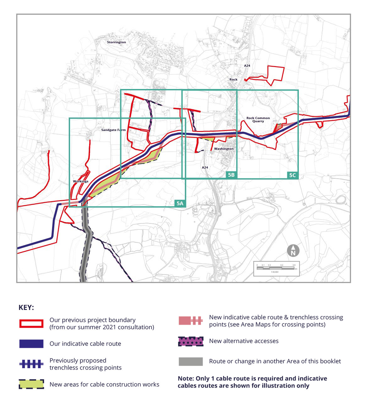
This Area considers the cable route where it would run west and north of Washington. It includes three modified routes (MR) and three alternative accesses (AA). They are all referenced on the following pages using the abbreviations above.
Our Environmental Assessment of West and North of Washington
On the following pages you can read about our preliminary assessment of potential changes in Area 5. We believe that effects presented in our PEIR from summer 2021 will change for historic environment (heritage) as a result of introducing these alternatives. You can read more about our consideration of these potential changes in our PEIR SIR at Formal Consultation Detailed Documents 2022 – Rampion 2. Just look for the relevant MR, AA or TC reference.
We’ve split this Area into 3 smaller areas 5a to 5c. You can use the map to figure out where you are most interested in and find out more on the following pages.
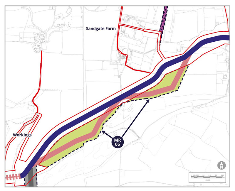
Modified Route MR-06
MR-06 is being included to allow the cable to run closer to a southern field boundary toavoid an artesian well (where water is underground under positive pressure) andequestrian facilities, which will also enable agricultural activities to be less impacted duringconstruction. The modified route would maintain a 15 metre (m) distance from a localwildlife site and woodland to the southeast
Potential Environmental Impacts
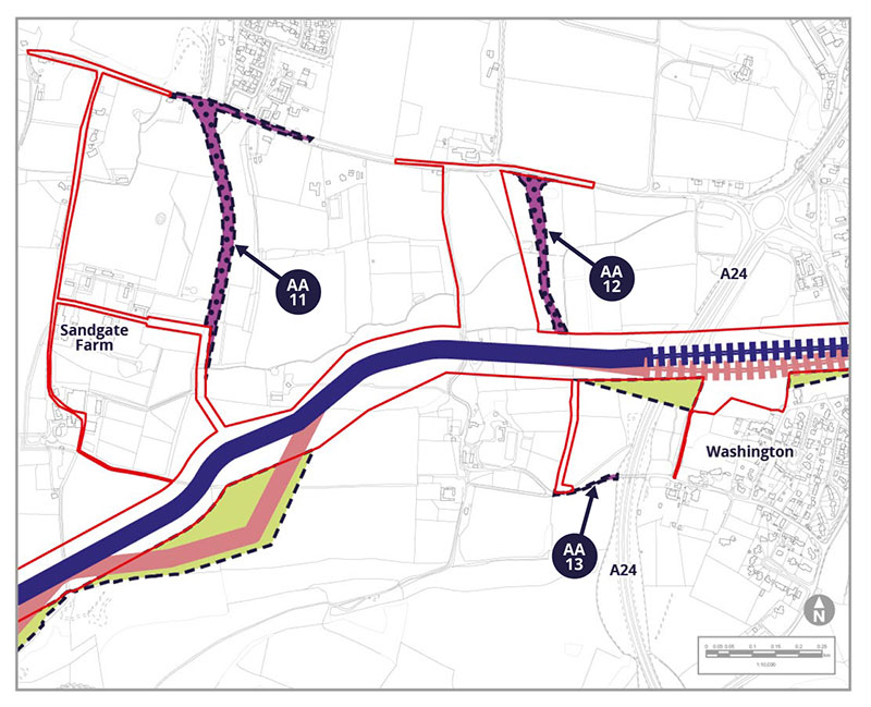
Alternative Accesses AA-11, AA-12 and AA-13
AA-11 is being explored due to technical challenges we found for construction use on our original proposed access route further west, whilst AA-12 is being considered as we identified that our original proposal would be unsuitable due to road safety concerns. Both alternative routes would run on new tracks and maintain a 15m separation distance from adjacent woodland. AA-13 Is an existing private track which we are including to ensure we have rights of access over it.
Potential Environmental Impacts
AA-11 and AA-12 would cross agricultural fields and require new temporary stone roads. Both would cross hedgerows and AA-11 would pass close to listed buildings. These receptors have been identified in our PEIR SIR as either new, or with the potential for a change, in relation to landscape and visual, ecology, nature conservation, historic environment (heritage) and transport effects
Modified Route MR-07
MR-07 would be an alternative route for the trenchless crossing under the A24 London Road, the recreation ground and roads to the east including the A283. This is being proposed to allow more flexibility for laying out of ducts, to help maintain distance from Ancient Woodland and provide a better angle to cross an existing gas pipeline. Although our trenchless crossing may move slightly into MR-07, this would not change the assessment of effects we consulted on last year.
Modified Route MR-08
Modified Route MR-08 is a slight adjustment of the cable route to minimise severance of agricultural fields.
Potential Environmental Impacts
MR-07 would be mostly underground for the trenchless crossing. Drilling would occur from a similar area to our existing proposed cable route and therefore no new receptors or changes to impacts have been identified. MR-08 would be closer to receptors including a house and farm to the north. It would also cross two additional hedgerows.
These receptors have been identified in our PEIR SIR as either new, or with the potential for a change, in relation to landscape and visual, ecology and nature conservation, and historic environment (heritage) effects.


